Home 
 Cro., Bosna, Monte
 Moravica (Golijska)

River Moravica (Golijska)
80% 
-
Source of:
-
Lenght of river in km:
98
-
Difficulty:
| |
Part
|
river km
|
Difficulty
|
| all | village Dobrace - mouth into Z. Morava (Town Arilje) | 17 - 0 | WW I - WW III |
|---|
- Conditions:
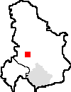
River Moravica Golijska is situated in Western Serbia. River can be ENTERED from main road Аrilje-Ivanjica, at the turn towards village Dobrace (on the 17.km) ,the EXIT is just before entering the city Arilje, close to water collecting dam called Bent (on the 4.km). The section is 13 km long, it can be crossed in two hours, water flow is very strong, there is enough water for rafting all year round, any kind of boat can be used. There is, during spring, class III river rapid on the second kilometer, then along the way there are several class II rapids and at the end there is a decent down the dam Bent which I would mark as class III. There are famous natural beauties within 4 km stretch of the river: canyon Panjice, waterfall Panjice and Vodena Pecina (eng. Water Cave). River passes through two towns and therefore it's not entirely clean
- When, who, how long, type of boat:
The limits are defined almost for canoe. For kayaks can limit a few cm less, for rafts higher.
| Part | when | Water gauge | type of boat | recommended for | speed of flow |
|---|
| all | all year | | kayak, raft | experiences | 2 h |
|---|
- Character of river:
| Part | width or character | countryside |
|---|
| all | 10-15m | valley |
|---|
- The best part:
upper
- Dangerous part:
- Usual put in and take off point:
- Continue on river:
Veliki Rzav
- Access to river:
the road only from bridges.
- Camps:
(Add new link
)
 Facebook
 RSS 2.0
Email na redakci serveru
raft.cz
Chcete psát články pro
raft.cz?
Trička a mikiny
raft.cz
O
raft.cz
Uvedené texty mají pouze informativní charakter. Vodácký sport je
potencionálně nebezpečný a vždy je nutné posoudit zobrazené informace dle aktuální situace.